
Yesterday morning Chris and I went for our first Vermont bike ride. We had decided to do the Stowe City Weekend ride first published by the Green Mountain Bike Club. We found the route on bikely.com, which lists maps and sometimes cue sheets for the suggested rides. When I first found this route, I posted a comment asking about the hills, to try to get a feel for how bad the climbs were/are.
Well, I’m here to tell you they’re bad!
Vermont riders must be some of the hardiest of the bunch to be able to tackle these hills on a regular basis. I think if I rode here regularly, I’d never need Weight Watchers.
The ride started out easy enough – well actually cold enough, because you see, our house, Goldilocks is about 1.1 miles from Stowe – straight downhill, at about 8:30 in the morning or so, with the windchill, it felt like 30 or so degrees (Fahrenheit that is – 0 to my European friends). Luckily, Chris told me to bring my long-fingered gloves, and I was wearing my long sleeve jersey and windbreaker, so it wasn’t too bad – though my toes might disagree.
Oh and as we were screaming down that hill into Stowe, my mind kept asking, “How the hell are you going to get back up this hill at the end of the ride?”
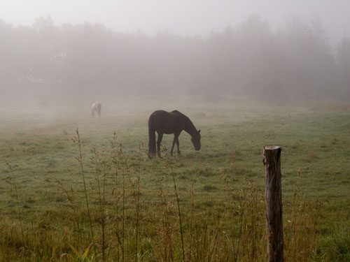
From Stowe, it was an easy shot down 100 to Randolph Road which wasn’t too bad a ride, and pretty going in and out of the fog.
Randolph had some rolling hills but really was a beautiful ride until we got back on crowded 100 into Morrisville. Here our cue sheet (telling us where to turn and when), first let us down, missing a left onto 100 but we went with our gut instinct and continued.
Again, some incredible vistas of the Green Mountains, though a bit of a crowded, fast road (speeds around 50mph). The cue sheet let us down again, at an intersection where 100 went to the right and 15 went straight. We knew we were heading for Johnson, so opted to follow 15. And as we tackled those incredible rolling hills, my mind said, “This better be the correct route! Can you imagine having to backtrack this route?”
Finally, after I thought my lungs would scream at me if I pushed them anymore (did I mention I used my inhaler before leaving the cabin? Good thing, as it is, I think it’s running low and I need to get a new one), we had an amazing downhill into Johnson, where we checked the cue sheet and realized just according to the Elevation column, it looked like over the next 4.5 miles or so we’d be going from 160m to 256m (about a 300 foot climb). The cue sheet is a big fat liar!
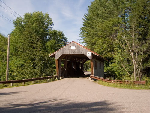
By the way, just coming out of Johnson, we spied our first (and only) covered bridge.
So, my plan for the next few miles, into North Hyde Park, is to just take it slow and steady, which I do, and it works great. I handle that elevation gain – no problem.
But now, why the cue sheet is a big fat liar. The cue sheet is a big fat liar because while it tells you the elevation at each turn, it does not tell you the elevation changes during the miles between those turns. So for example, from the time we turn right on Ferry Street to the time we turn right on Centerville Road, it shows an elevation going from 264m to 251 meters, a decrease (thinking downhill), right? Wrong!
What you don’t know is somewhere in the midst of that 4.45 miles, is a honking mother … well you know … of a hill with a 250 foot (roughly) incline that the first time in my two years on the bike, sent me walking. I just had to do it. I couldn’t make it up the steepest part, but I did get back on the bike to finish it off, but man. That was nasty.
The next 13 miles or so were back to your normal ups and downs, we went through Centerfivlle, and Hyde Park, and then picked up Stagecoach Road. Now I had been warned by some website about Stagecoach Road, “Take Stagecoach Road back for a slightly more challenging option to the ride above” that’s what it said, and the “ride above” to which it referred was Randolph Road which didn’t give me problems. Though my mind said, “Take Randolph Road back. Find Randolph Road.”
Should have listened. Oh but let me back track for a minute, because in Hyde Park, as we turned left onto Depot Street (aka Cady Falls Road), you come to this “bridge” it’s one lane (on a two-lane road), and it has stop signs on either side. It gives the illusion, that there’s no road on the other side of the bridge (because of the steep downhill), that you just go over the bridge and fall into oblivion. Even after seeing a car come across the bridge, I just couldn’t ride it and walked across, that wooden planked monstrosity. Wish I had taken a picture.
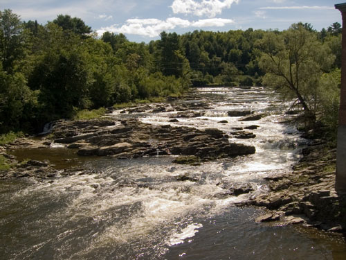
Also before turning on the now infamous Stage Coach Road, we crossed another bridge, over this great stream, near an old hydro-electric plant (maybe these were the Cady Falls).
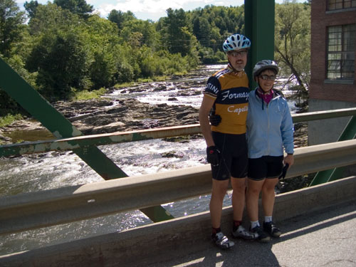
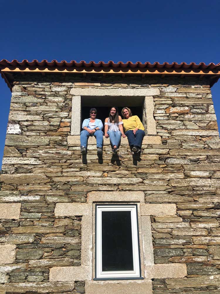
It was about this time we met Ron, a way stronger rider than me (he had done Smugglers Notch the day before and was doing it again at the end of this ride; he had to, he was staying up there). Ron took this great picture of Chris and I:
Now back to Stage Coach Road – okay let’s just say I didn’t get off my bike and walk. Though I thought about it. I also thought about sending Chris on ahead to get the car and come back and get me while I sat in a meadow with some cows and worked on my tan. I didn’t do that either though. Two different hills (like 300 feet climbs), forced me to stop two times but I just rested, caught my breath and traveled on. Chris said I was in caged-animal mode but at least I warned him and he rode ahead, waiting at the top of each of these hills to make sure I didn’t keel over and die. Ron sensed it too; once we gave him directions into Stowe, he road on ahead and I guess back to his wife, who was smart enough to stay at the hotel and wait for him. Feel bad that he saw me at my worst – nice guy.
Finally, the end of Stage Coach and we were back on 100 and heading into Stowe – easy peasy, except for one thing, that 1.1 mile uphill and 363 feet climb back to our house. When we got to our turn at School Street, Chris said, “Wait here, I’ll go get the car.” But now that I was resolved to taking these hills in increments with rests along the way, I wanted to give it a try. So I told him, to go on ahead, get the car, but I was going to ride until he found me.
I did that hill, stopping twice along the way to suck down the rest of the water, and I arrived back at Goldilocks as Chris was getting into the car to come back to get me – phrew!
There are two more things I want to note, 1) Hills here aren’t rolling (at least on this route), you can’t get momentum from one downhill and use it on the next uphill, like back in Jersey. You go downhill, you go flat and then you go uphill – it sucks. 2) According the elevation profile on bikely, I climbed 2545 feet on my bike yesterday (not including the 365 foot climb home); that ain’t nothing to sneeze at! Oh and don’t give me the fact that I descended that much too; I earned those downhills.
After a quick shower and change it was off to Pie in the Sky for some much deserved pizza (and beer) that never, ever tasted so good – well okay – the pizza after the century tasted just as good.
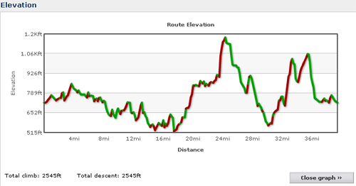
Elevation Chart – Stowe City ride


[…] repeating our Monday ride from last summer. I’m hoping I’ll have an easier time of it this year or at the very […]
[…] of you may remember this entry from our last trip to Vermont, I’ll Take a Century any Day. It describes the first ride we did in Vermont. Well, this year, we decided to do it again – […]