
So what do you do when you wake up at 5:00 in the morning and your husband is snoring cheerfully beside you? Get out of bed, turn on the computer and see if your daughter has updated her blog from Australia.
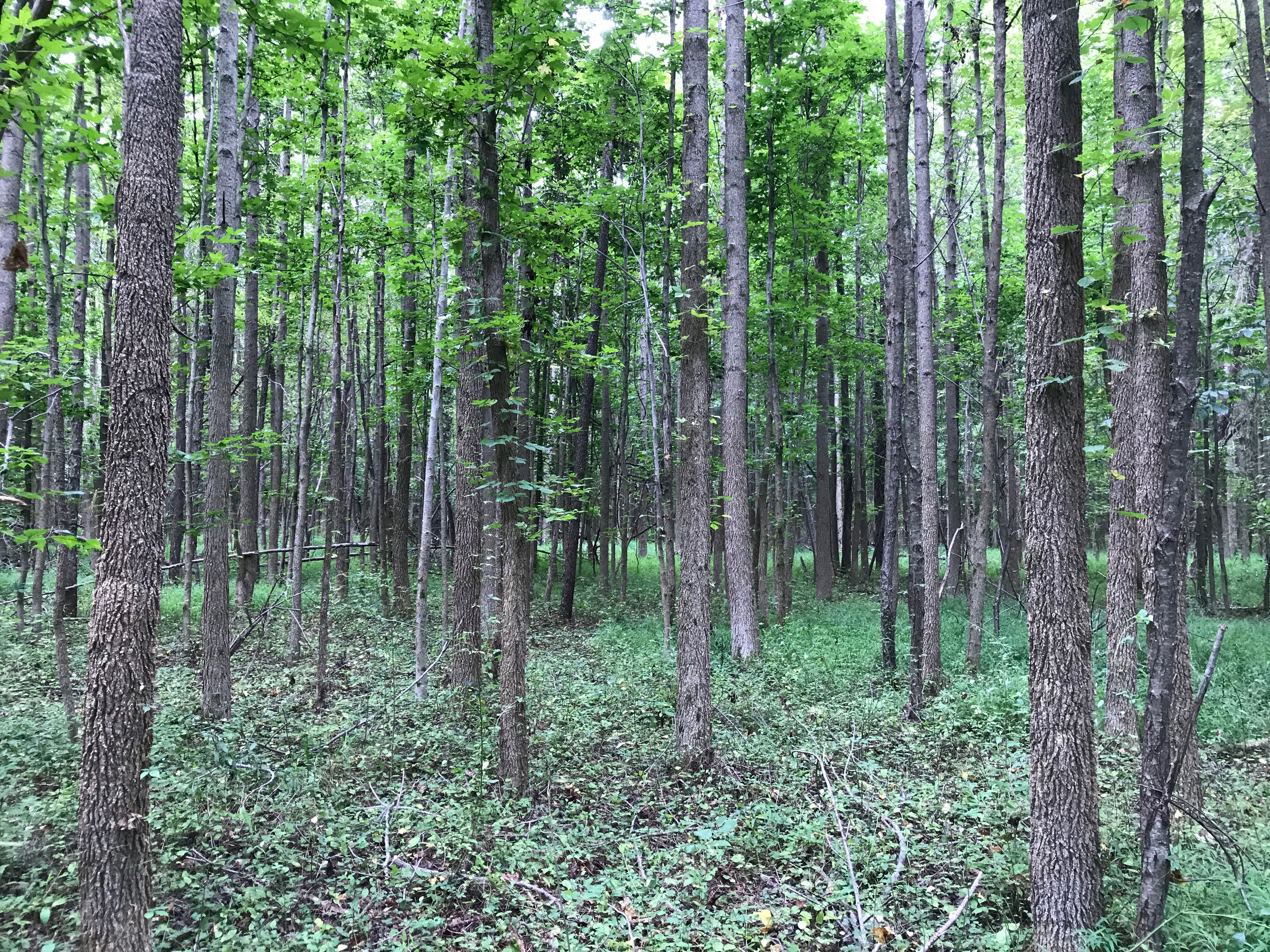
She hadn’t and after taking care of some things (like checking the weather forecast, it was supposed to be miserable), I decided to go for a bike ride. Nothing too complicated, but I really wanted to go down the road our house was on to see where all those cars were going to and from the night before.
I plotted what seemed like a good course, using back roads to Waterbury Center, then getting on 100 for a bit, before returning to the back roads and home. The only problem was the elevations – but I figured, Chris was still sleeping, and if any of the hills were too big, I could just turn around and come home.
Then I got a ping, about 6:30am – just as I was ready to walk out the door. It was Becky, IMing me from Australia. Cool! We “talked” for 25 minutes before she asked me to wake Chris so she could “talk” to him too. I did and of course, once he finished and saw me all decked out in my riding gear he wanted to come along too – great.
So after he got ready, we took off. And sure enough kept pedaling hard and fast ahead of me until I finally yelled, “Your killing my nice leisurely ride. Go ride by yourself.” Well, he got the not to subtle hint and slowed down as we tried to figure out my course.
The problem with using google maps, or bikely or mapquest to plot a biking course is that all of them assume that the roads actually have signs telling you their names. Well, I’m here to tell you, they don’t! And needless to say, my pretty straight forward course landed us on some unpaved (aka White roads) that if Chris had plotted them I would have been screaming. Luckily, he had the good sense to not say anything.
As we rode though, I kept my eyes out for wildlife and again was rewarded, this time with a squirrel! The squirrels here are small and red and way harder to spot than our squirrels. No, moose, no bears but hey, squirrels!
Eventually, after some crazy down hills, we made it to 100 (a main artery up here – similar to route 27 in NJ except hillier – well everything is). We opted to take that home with a quick stop at Cold Hollow Cider mill for a shared donut.
Now last year, the hill leading up to our house broke me. I think I rested twice as I rode up it. This year, not once, and Chris proclaimed the Riemann Hill Training program a success, with his huge cat that ate the canary grin. I told him to wait until Monday’s ride but I did make it so you have to give him some credit for pushing me to ride in the hills of the Sourlands.
After that 18.5 mile ride, we decided we deserved breakfast, and headed over to the Dutch Pancake cafe, where he got a stack of blueberries and I had some egg beaters with veggies and part of a thin Dutch pancake – yum.
Next, it was off to church for Chris – now originally, the plan was for me to go to the Farmer’s market while he was in church, but it was pouring and there was no place convenient to the market to have a cup of coffee while I waited for him (as much as I love farmer’s markets, there’s no way I could spend an hour in this one, in the rain). So I sat in the car and read Aurelio Zen while he prayed. Yes, I know, a really good wife would have gone to mass with him, but I never claimed to be a really good wife.
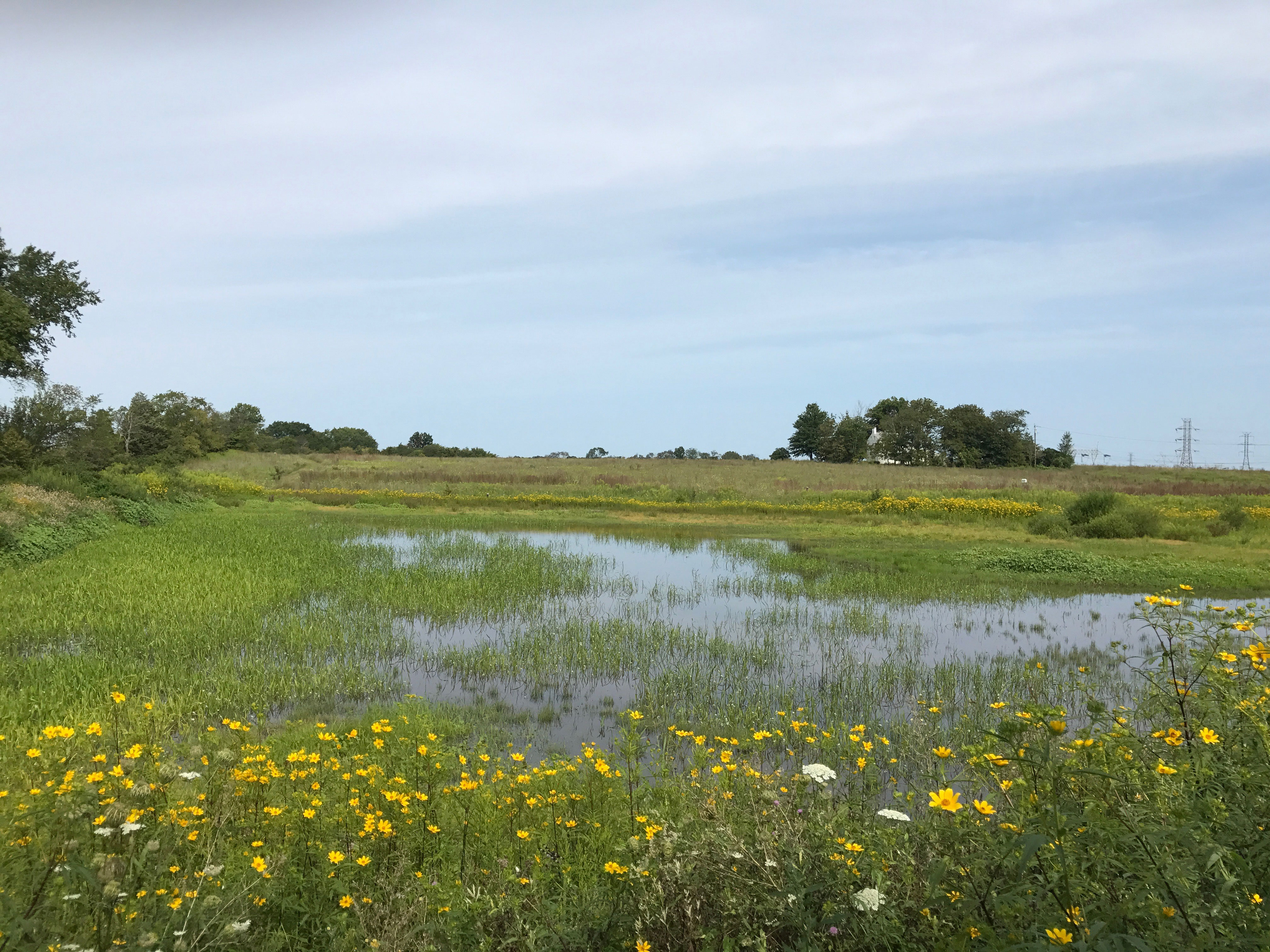
After mass, the rain had abated some, so we hit the market together. Being early in the season in Vermont, they still had strawberries (which I forgot to buy), and many of the veggies we saw in Jersey a few weeks ago. We opted for some salad ingredients, some really amazing snap peas (which I must go get and snack to snack n soon), some sheep’s milk cheese, two filets (for dinner Monday night), and the restocking of some of the canned goods we got last summer.
A quick pop into Mountain Cheese and Wine to get some Vermont sharp cheddar and a local blue and we were good to go. We don’t get wines at Mountain Cheese and Wines as we find the prices a bit high for some stuff we see everywhere, but Chris knew this and brought a few wines with him to hold us over until we got to our favorite wine store on Monday, Fine Wine Cellars (see Jerry – I left it off the list intentionally as Chris packed the wines and he wouldn’t tell me what he brought – it was a surprise). One more stop at Harvest Market for some pasta (orrechiette) and we were done shopping for the moment.
Now back to the house where we checked the whether and checked the hiking books to see what to do. Originally, we had planned Mount Hunger for Sunday afternoon, but the idea of a 3.5 mile hike in possible rain (and thunder) totally didn’t appeal to me. On the radar, we saw a break in the clouds and decided to chance a hike up Mount Elmore, which the book listed as moderate and 2.5 hours.
The rain had pretty much stopped by now but we took two packs with our rain gear and a bottle of water each. I also packed my fleece because lately, I tend to get cold. Then we got back into the car, headed to Morristown and then down Route 12 to Lake Elmore State park, where we had to pay $6 to enter (whatever).
The parking is in the back of the park, after an uphill climb on a dirt road, which didn’t phase Chris’s car but made me glad I didn’t bring mine. All the spaces were filled but we managed to fit in along the road behind another car. The trailhead is well marked and the fist 15 – 20 minutes or so, you’re pretty much walking uphill on a gravel service road.
Then it takes a turn to the right, into the woods and we spent another 30 minutes winding around the mountain, going higher and higher, climbing into the clouds and hearing the wind roar in the distance. We finally came out in an area that Chris thought was the top, a bit of a bald spot, where the wind whipped around, but it wasn’t the top. The trail we were on was called the fire tower trail and there was no fire tower here (one of the books said you could climb it). That’s when I glanced up and sure enough, there was the tower above us, I couldn’t even guess how much higher! Oh, and stupid me forgot to charge the camera battery – so no good pictures here.
We backtracked down the trail about 50 feet and found the turnoff for the fire tower trail and began to climb and I mean climb. Up until now, the trail had been a combination of dirt and rock, but now we were mostly on rock, wet, slippery rock. Heck, at one point there was even a ladder we had to use!
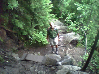
Chris at bottom of ladder – taken with cell phone
Eventually, we got to a point where we pretty much had to scramble up these two large slabs of wet stone with no holds and a drop off to the left of you. And, yeah, we got to do it with a family of four watching us from the other side, two young parents and their incredibly young daughters. How the heck did they do it!! Well, we managed, but you could bet I turned around to watch the family descend not sure at all how that would work. The little girls slid down on their butts to the waiting arms of their mom, totally freaked me out.
After that, it was more climbing, more gripping moss covered rocks, and trees for support before within 20 minutes we made it to the top. It was crazy up there! Clouds swirling, wind whipping and though both of us are afraid of heights, we did try climbing the fire tower, I couldn’t get past the first level and the way the wind was pushing, I wouldn’t let Chris go past the second.
Now it was time to head down and it was hard. Most of the time I went backwards, basically facing the mountain, climbing down as if I was scaling it backwards, with Chris guiding me as to where to rest my foot until we got to those two slabs of wet rock. Oh shit! Sorry, I don’ t like to curse here, but man, oh shit, oh shit, oh shit!
It was bad enough when we came up those two slabs, knowing the mountain fell away at our side, but when we were going down, I could see what lay in front of me, and that was nothing! Basically if I didn’t land on the path, I’d go over the edge. I panicked. Not a full blown panic but a panic. Chris had visions of carrying me down the mountain.
But I remembered those girls, and hell, I was filthy already, and I didn’t care, so I sort of slid down those rocks, like they did, on my butt, inching along like a crab, using my hands and feet wherever I could, and I did it! Well, of course I did because if I hadn’t you wouldn’t be reading this now. You’d be reading about the hiker trapped atop Mount Elmore, or the hiker who went flying off the side of Mount Elmore. We’re doing a higher hike on Wednesday and I’m a bit nervous – I’m beginning to think that getting to the tops of these mountains might not be good for a hiker who has height issues.
Well, eventually we made it all the way down as the rain started again, so we hopped in the car and headed back to Morristown, hoping that the Rock Art brewery might be open and that we could cross another one off my make-up list. Unfortunately, they weren’t. So then we headed to Shaws for some food shopping to fill in things we couldn’t get at the market (e.g., milk, OJ, pretzels).
Home for our second round of showers for the day (this time hot, as the weather had cooled from the rain and we were a bit wet from the hike), and then we spent a relaxing evening, enjoying some of our cheeses and wine (Chris had brought a Hitching Post Pinot Noir), while we watched the first 10 phases of the 1999 Tour de France, waiting for the 2008 tour de France to come on Versus at 8:00pm. Finally, we made some salad, and the pasta we bought earlier and tossed that with a pesto I brought with me from home (it was take as much basil as you want day at our CSA on Thursday – yippee)! For dessert, we enjoyed some red velvet cupcakes I also brought from home, and then hit the hay to the sound of pouring rain.
Oh, and yes, I kept waking up with starts for the first 30 minutes or so, after suffering through a series of falling dreams. I hate those.
[…] I can afford to charity 7. Been to Disneyland/world (both) 8. Climbed a mountain (have you seen hiking, biking and bears … not really) 9. Held a praying mantis 10. Sung a solo 11. Bungee jumped 12. Visited Paris (twice, can’t […]
Of course you are a good wife, you don’t need to say it. And “oy vey” what hills. You are a much better person than I.
So, Kim, tell me again why you like doing this stuff? Sure sounds like a lot of pain, fear, and suffering for the chance of flailing about in the woods (or on a mountain) on a rainy day. This is your idea of how to have fun on vacation?